Monday, July 30, 2007

Pictures of stuff..

Well, there ya go. You can see the blueness and compare it to the normal black color further up the fork....it's on both sides and odd that nothing on bike got messed up....
A cloudy Kentucky landscape...
The cyclist shelter out in Booneville, KY after a long a strenous day of climbing
Another Kentucky landscape...minus the ominous looking clouds

Day 37 (7/29): Springfield, KY --> Booneville, KY (132 miles)

Days mileage: 132 miles

(time short here in library so makin this one short and sweet...)

- terrain gettin tougher and tougher the more east I go...just like all those bikers headin west told me....who would have guessed?

- cloudy weather all morning which kept temps nice and cool...then sun came out which kept temps nice and hot

- found a neat shelter behind a Presbyterian church in Booneville that was made specifically for cyclists...it had a shower, shelter, sink, table for eating, and electricity...cool deal

- main part of day was tryin to iron out where I'm goign to end my trek. The more I think about it the more I realize I'd like to end the trek in my hometown in a place that has more meaning than being the "official" end of the trail...so I decided upon ending at the top of the dam at Sugar Hollow...I think this would be the perfect spot since it's one of my favorite places in the world...and I've spent so much time fly-fishing, hiking, running, biking, thinking, etc, etc out in those woods...furthermore, it has a great view of the Blue Ridge Mountains and the Moormans River flows through that neck of the woods. This will, obviously, let me finish a few days earlier and I won't have to deal wtih the beach traffic headaches that will increase the more beach-ward I go. I feel this is the right decision and am even more excited to finish up. If I stay on schedule I should be at Sugar Hollow dam by Thursday (Aug 2) evening...hopefully a good sunset too (?). Anyways, that's the jist of my thoguht process right now.

Day 36 (7/28): Rough River State Park, KY --> Springfield, KY (121 miles)

Days mileage: 121 miles

It poured all night long and around 1230 AM the biggest storm I have ever laid witness to rolled through our campground. It really was an earth shattering type storm. I stay curled up in the fetal postion, daring not to move a muscle, while I heard grown men with full fledged beards crying out loud for their mothers. It sounded like total chaos out there on the flip side of my 1mm thick layer of tent material. The rain got heavier and the ground refused to soak up any more....this left one option for the rain and that was to puddle in every knock and cranny it could find upon the outer surface of the earth's crust. Furthermore, there was just so much my tent could keep out and it eventually gave up the battle and water slowly started to creep into my territory.

A few curse words made their way around when I discovered this happening and even more seeped out when I found that my sleeping bag was now acting as a giant sponge.

I thought about whether or not to risk runnign out and to the shelter that was no more than 30 yards from my tent...but, lightning was coming down prob every 15-30 seconds...I figured I'd best stay put and hope for the best...

I rose early to get rolling and try to put the sleepless night behind me. I started to roll out of camp and was pedaling out of the saddle when I looked down at my front wheel....and then the fork of the wheel and noticed something...

I stopped. Looked closer. Crouched down and rubbed my finger across the surface.

I stood up in astonishment.

My bike had been hit by lighting last night.

The first 3 inches of the fork (on both sides) was now a neon blue color that def was not there when I leaned it against the picnic table the night before. I went to ask two otehr folks and they were in just as much disbelief as myself. My bike, indeed, had been hit by lighting.

Yikes!

I pedaled on into another rainy day and thought about the bike, then about the storm, then about Kentucky, then about the slowly chaning terrain...

The hills were gettin uncomfortably short and steep in grade.

I finally got to Springfield, KY where the air smelled very unpleasant...I was just glad my bike hadn't blown up the night before....

Day 35 (7/27): Marion, KY --> Rough River State Park, KY (115 miles)

Days mileage: 115 miles

I awoke early in an effort to get a jumpstart on the humidity. The Kentucky terrain continued on in a gradul and somewhat flat-like manner that def met the approval of my tired legs. There was also a slight tailwind to nudge the progress along a bit quicker. With each turn in the road I was pretty shocked at how many fields of corn there were...I thought Virginia had a lot but Kentucky def takes top honors for seen corn fields.

Around lunchtime I swung into a library to update blog and then headed on, deeper and deeper into the bluegrass state.

Around 2:00pm I def hit the wall as far as fatigue goes (mentally and physically). I thought I had been eating enough all morning, but figured I'd better be safe than sorry and stopped into a Mom and Pops type place to order up a great 2.00 sandwhich. Right when I stepped back outside and clipped into pedals the rain drops began to parade down towards the very earth of which I pedaled.

Awesome.

Well, it actually was pretty awesome. The rain showers brought temperatures down a great deal and I was able to get a load of laundry done that I'd been procrastinating with for a little bit longer than a long time...

It poured for the next three hours of the day and I found it to be more and more of a joyous occassion. The rain brought a nice change of pace and added a diff shade to the surroundings I'd already grown.

Anyways, I finally pulled into Rough River State Park and decided I'd camp there for the night. It was nice to finish biking around 630 for a change and gave me some time to relax before settin up and throwing some dinner together.

I ended up gettin a free meal from a friendly RV fellow who lived in Indiana and was the president of some hospital up there I believe. We chit chatted for a while about our various travels, etc.

I then set up my tent and went to sleep with the sound of rain starting to get heavier and heavier as I fell deeper and deeper into a deep sleep....

Friday, July 27, 2007

Some more pics of past few states....

My pleasant companions over in Eminence campground area...Bruce and his dog Bear
A typical stretch of Ozark
The Mississippi River and it's bridge I had to race across to beat the trucker traffic in coming over...When took this picture I was in Illinois and looking back at Missouri
Mr. Pop-Eye himself looking sharp as a tac for this group photo

Day 34 (7/26): Chester, IL--> Marion, KY (137 miles)

Days mileage: 137 miles

The traffic trying to get from Chester to Murphboro was pretty lame and forced me to surrender myself to the side of the road (nearly in the bushes) to avoid gettin plowed over by overzealous tractor trailors and dump trucks...so it took a while with all the stop and starting taking place.

Humidity had already soaked through everything within the near and distant distance with a sun already promising another hot and sticky summer day. Hurrah for east coast summers....

I'll just say right here....rather than sayin it later....Illinois has got to be, in some shape or form, some nearly related identical twin to Missouri.

It was hilly, with steep hills tossed inbetween those hills, and then there were some other hill-like forms tossed inbetween the hills that were between the hills that were between the original hills.

Anyways, as I was sayin. There were a lot of turns that had to be made and I'll be the first to admit that I missed a good bit of them. I was not used to having to make tursn on different roads....rather out west you just sit on one road until all the cows, and cowboys, came on home.

My goal was to get out of Illinois, and I did. I was rolling on thru the hot evening when I sudenly saw the Ohio river to my right...woohoo! I started to pedal harder to get to the ferry that would...ferry me across...but my legs refused the offer of inspiration....so I just steadily plotted along until I got to Cave In Rock..hoped on the ferry...said ta-ta to Illinois and rolled straight on into Kentucky....it was 7:30 pm and the nearest town (Marion) was 12 miles down the road. I clipped into the pedals and started booking it towards Marion....the amount of sunlight left in the day was about gone and I feared the idea of having to plod along thru Kentucky in the dark.

It was a huge relief to finally roll on into town around 815 pm...just in time to get a strawberry milkshake and call up Loretta to know I arrived safe and sound. I then meanedered on down to the old city fairgrounds and pitched my tent behind what once used to be an old concession stand. Some stray dogs came and kept me company while I glanced over maps and journals with my headlamp.

My legs were tired and it was gettin late. It was a clear night in Kentucky with a nearly full moon making it's nightly charge towards the zenith of the night sky. I zipped the tent shut and feel asleep sooner than I could have expected....

Thursday, July 26, 2007

Day 33 (7/25): Eminence, MO --> Chester, IL (132 miles)

Days mileage: 132 miles

Ready go!

Ozarks Ozarks Ozarks. That's all I've had on my mind from right when I crossed into Missouri and that's all I'd have on my mind unitl I cruzed on down that last descent and into Ellington.

It was a lot of steeeeeeeeep climbing....grades of roads I never really thoguht possible...but, slow and steady seemed to be the plan of action for such mountains.

I, again, felt like I was in Virginia...on the Blue Ridge Parkway or something...except no scenic overlooks to use as an excuse to pull over and catch one's breath. The only excuse I had to take a break while climbing was that my container of Juicy Juice somehow fell out and rolled down the hill I had just climbed....seein it was still halfway full AND grape flavored (the best flavor for juice)...I had no chioce but to dismount and go rolling down the hill after it...calling out for it to "hither to! hither to me Juicy Juice."

The rest of the day would be though. No way around it. Hot hot weather and lots and lots of steep, short climbs that tested my mental and physical determination. My goal, after gettin out of the Ozarks, was gettin out of Missouri.

Let's just say...when I got to the last climb, looked towards the east and saw a wide expanse of flat fields I knew I was dman close to the Mississippii river. I could see it more and more as each mile rolled by. Then I saw the brdige that would support my efforts towards Illinois....then I saw the state sign...and then I saw Pop-eye the Sailor Man....yes. This was his homestate too and a statue had been erected in his honor. I gave it a hug and had deep converstaions with him about why the Mississippi was such a big milestone for me on this trip...he just smoked his pipe, flexed his arms, and nodded in a fake sort of understanding.

I rolled to a Mexican restaurant and then to the city park and went to bed...

Goal achieved and Missouri behind me for good.

Day 32 (7/24): Marshfield, MO --> Eminence, MO (110 miles)

Days mileage: 110 miles

Another day in Missouri where the hills seemed to become more of a way of life than a nuisance. The first day laid witness to some of the steepest roads I've ever seen while this coming day resluted in a more rolling landscape. I knew that the Ozarks were closing in on me...or maybe it's the otehr way around. Unfortunatly, they would be at the end of a long and hilly day if I chose to tackle them today.

I figured I"d wait and see how me legs felt come that point in time.

In the meantime I talked to myself for mile after mile after mile....flipping thru some Dylan albums in my mind and realizing more and more how deprived I've been of hearing some of that good ol' music.

The landscape was taking on more of an east coast appeal...minus the Blue Ridge Mtns.

I ran into a bunhc of folks heading westbound today...a retired couple, three guys from France, and one lone ranger dude right before I pulled into the town of Houston to take a break. Once I got to Houston there was a cool little motel that was very biker friendly and had free internet access and the works. It seemed to be a biker haven.

I got to the town of Eminence and decided there to call it a day...it had been 110 miles thru Missouri...and though it was only 25 miles to get to Ellington those 25 could easily prove to be very slow and strenuous on my already fatigued legs.

I stocked up for dinner foods at the local grocery store and headed to the camping area next to the river, pitched camp, ate food and...finally, got some fly fishing in...no caddis fly hatchs or anything...so I just tossed a Muddler Minnow out in the currents for an hour or so and then meandered back to camp. It felt nice to stand in a river again and I thought back to all the times I've spent standing in rivers in the Blue Ridge Mtns and the Shenandoah Valley.

I yearned for those rivers all over again and started to fish them again within my mind...knowing this time around where all the fish would be waiting. Not particularlly for me to lay a fly over them, but perhaps for something I could never offer them regardless of how polished of a cast I delivered...

I snapped out of my mind-wandering manner and spent the rest of the night talking with a fellow named Bruce ( and his dog named 'Bear') who had been traveling on the road for the past 11 years of his life. He did vinyl work for folks all over the country and enjoyed not living in any place. He said he always loved coming back to the Ozarks and went on to tell me how much the town of Eminence has changed from when he first used to come here. He then went on and on about politics and the American government and about how there may have never been a real moon landing and it could, easily, be a conspiracy....

After I had a big enough helping of such deep conversations I retretaed to my tent and sing through another Bob Dylan album....I've had his latest release 'Modern Times' in my head for a good while....so figured that would be good as any (b/c all his stuff is amzing afterall)...

The Ozarks were waiting for me as I slept a restless sleep...

Tuesday, July 24, 2007

Some Kansas Pictures....

Well...you all can connect the dots on your own.....but I sure wouldn't have been able to jump over that.
A typical Kansas stretch of road...this was evening I was riding into Cassody and looking back west towards road freshly traveled over.
Sunflowers for everyone!

Day 31 (7/23): Girard, KA --> Marshfield, MO (130 miles)

Days mileage: 130 miles

Another hot and humid morning with nothing the thought of getting out of Kansas hanging fresh over the yonder horizon line...so I made haste in packing up my gear, eating, and pedaling towards the east....it stayed relativly cool for most of the morning, but by the time I stopped for lunch in Golden City the humdity had hit the fan and the librarian was telling me to sign in to use the computers....

After a break of eating and updating blog I started to bike deeper and deepr into Missouri. Kansas was already a distant memory and the current was already testing my legs and determination to get to Marshfield by days end. The landscape slightly mimicked that of eastern Kansas with rolling terrain and more and more trees hovering over the road.

I made sure to stop often to restock in water and in rehydrate myself to heed off any form of unwanted physical distress...Once the map hit Pennsboro the terrain took a turn towards the sky..quite literally. Steep, steep, steep climbs were waiting for me after each turn in the road....and luckily there was just as steep of a descent on the flip side. There were some climbs so steep in grade I thought I was going to fall back off the bike...no joke....even in the easiest gear and standing up progress was slow, but at least steady.

I shoved the thought that this wasn't even the Ozarks yet towards the back corner of my mind....

Near the tail end of the day I passed some folks all heading westbound. One was a pair of guys going all over the place and mainly following the western tier route.....the other fellow was from England and I saw him in Marshfield updating his blog...he was great to chat with and helped take mind off of my tiredness and desire for food. We discussed the terrain the other would be facing within the next day or two and all that cool jazz.

I checked into a cheap motel for the night so I could stock up on some sleep and not have to worry about being atackd by mosquitos and/or the humidity.

Monday, July 23, 2007

Day 30 (7/22): Cassody, KA to Girard, KA (145 miles)

Days mileage: 145 miles

Fog sat heavy on my immediate surroundings as I broke the tent poles down and geared up for another day on the bike. It was slightly chilly and a Sunday morning. Maybe no one would be on the roads for a while? I was willing to take the chance that early starts worked out best…
My legs felt surprisingly fresh despite the strenuous efforts from the past...30 days…ha…and yesterday in particular…more of the same rolling terrain with a crosswind teasing each stroke of the pedal.

I biked through more flooded areas of Kansas, not realizing how bad it must have rained in this area of the world…a local guy told me all that rain happened about a month ago…and to me it looked like it had just rained….bridged must have been underwater…even houses and roads were gone….I bike thru a ghost town called Toronto and concluded that they all left when the water levels started to creep up towards their doorstep…I’m prob way wrong…but anyways…I was worried I’d be face with more wading thru marshland seein the roads I was rolling along on all ran parallel and around a big reservoir…luckily no issues…

I biked into three lads from England who were biking east too…I rode with them for 5 miles or so and then bid them a good day.

After getting poured on for 20 minutes I finally got to Girard, KA around 730pm….I was tired and my legs were shot…I found the city park, pitched tent, made dinner, and watched the mosquitos swarm around my sweaty and tired body…none of that mattered though b/c I knew I’d be in Missouri early tomorrow morning (Girard is only 15 miles or so from the border) and soon Kansas would just be another memory I’d be talking about later on down the road…

Day 29 (7/21): Larned, KA to Cassody, KA (159 miles)

Days mileage: 159 miles
Well, well, well….those ducks in the duck pond kept me up all night long….It was a flock of about 30 quakers and there was a handful in there that seemed to have a problem with quaking while they slept. It was so damn annoying and I could not get to sleep with such noises jumping in, out, and through me eardrums…so, when 4 AM rolled around I decided I’d just get up, pack up my gear and head out towards the east…

I ate some pasta for breakfast (blah), strapped on my headlamp and put on my neon orange vest and headed out….Once the sun started to shed light upon my surroundings I could see that I was now surrounded by a marsh land with tons ands tons of waterfowl (well, more like 3 or 4)….there was a slight tailwind nudging me ever so gently when suddenly I saw one of those road-block signs blocking my intended direction of travel…

I went around it to see what the silent commotion was all about and soon saw that the road suddenly ended…or, became a small cliff, or, was washed away to some other Kansas county….there was, basically, 15 yards of road missing which meant I would have to take alternate roads to get around this mess…I glanced around and realized I was surrounded by marshlands, barbed wire fences, bovines, and crappy Kansas roads…

I looked at my maps and decided I ride north and try to get around the lack of road….after five miles the road turned to sand and I cursed the sky, and myself, for an excess number of minutes…there was no way I’d be able to ride in sand (and why did they use sand in the first place for country roads?). I had no choice but to turn back around and think things through again…a wasted 10 miles of effort that got me nowhere nearer to getting to the other side of the washed out road…

I reassessed things and concluded the only option was to get over the barbed wire fence, wade through the marshland, ford the raging stream, get back over the barbed wire fence, and continue on with my life….

And so it began…I tested out the fence to see how much give it would have if I tried to tight rope walk on it…it was damn secure…I hoisted my bike up and heaved it as high as I could over the fence…It, naturally, got snagged and caught on the fence and toppled down and over into the marsh.

I was soon to follow…though my shorts got snagged while falling down and off of the fence…The herd of bovine stopped and stared at me wondering what I was intending to do next….well, I brushed me self off, made sure nothing broke on bike and slowly pressed through the ankle-deep marsh muck and used my fly-rod case as a means to clear a path to walk through the chest high marsh grasses.

Then I came to the stream that was pretty high still….I tested it out before carryin my bike across….it only came up to my crotch area and I sank down a bit more d/t the silt making up the riverbed….whatever. I had no choice…I hoisted the bike onto my shoulder and started to wade across the stream….i then had to wade thru the much and grasses to get towards the barbed wire fence and get back across…this time, instead of lifting my bike up I figured it’d be best to take my time and unload all the gear and just toss it up and onto the road above me…well, this worked fine and dandy until gravity got in the way and prevented my might from throwing the gear farther than I desired…my tent rolled back down the hill and into a flooded area/gutter….
All I could do was stand in the blazing heat and stare at my tent bag sittin in a nice big, deep pool of water. I was more careful with where I tossed the rest of the gear and more careful in getting over the fence as not to snag myself again…

The whole ordeal (riding 10 extra miles, getting thru marsh, etc) took an extra 1.5 hours or so….good thing I got up at 4 am right?

The rest of the day was a usual Kansas day (see any other entry from Kansas section). The big difference though was the changing in landscape. Yes, even my weary and biased eyes could see the subtle changes in the way the land was starting to roll, the roads actually had turns to them, trees were starting to appear in closely-knit clusters…I wiped a gallons worth of sweat from my brow and pedaled on into the headwinds…

I didn’t stop riding until 830pm when I pulled into a town called Cassody…I then started to think about the book “Once A Runner…”…fitting enough. I def missed running and even though I had just biked 160 miles I yearned for a pair of running shoes to get back that good ol’ running feeling.

I had to settle for left over pasta from that morning for dinner and retreated to the familiar walls of my tent…the only things that seemed to be familiar to me anymore...

Day 28 (7/20): Scott City, KA to Larned, KA (121 miles)

Days mileage: 121 miles
Rolled out of Scott City early on hoping to ride thru some cooooool temperatures for the time b eing…..it worked…for the time being.
Same old story folks….headwinds, hot temperatures, Kansas terrain, identical looking Kansas towns (I’m rushed here in library so just jotting stuff down from past few days)
Met a guy who’s raising money for diabetes awareness later on in the day…good to chat with him about this and that, that and this.
Also, the fence posts out here are made of solid stone..not stones stacked up on another but a solid piece rather…pretty coooool.
Hmm..what else..
That’s it for that day…long and hot and wondering if I would ever gain get out of Kansas…slept in the towns park in Larned..there was a nice looking duck pond and another xc biker who was heading east….though at a much more leisurly pace (35-50 miels/day)….mosquitos attacked me while I ate dinner…the usual…

Friday, July 20, 2007

Pictures from past few days....

Who needs coffee when you have black bears on your porch?
Loretta documents my tan line while I document more important things on the blog...
The infamous, cracked seat-post-rack.....
My loaded bike with gear piled on handlebars...then add on another pannier ontop of all that...gettin on was not very..fun...rather, it was nearly impossible...
Mr. Thunderbird himself with the end product of his version of seat-post-rack...A fine, fine end result indeed...Thanks again Mr. Thunderbird if you're reading this!!!! The rack is holding up great so far and has already carried me far!

Day 27 (7/19): Eads, CO --> Scott City, KA (105 miles)

Days miles: 105 miles

I awoke, ready for action and ready to try out my idea. It was 6am..so the day was still young and the heat still low. I started to strap all my gear onto the handlebars in as logical as one can do for such a thing....then I took my tent an tried wrapping it around the frame of my bike...one of the panniers I tied rope around so I could wear it as a back pack...I then put my sleepin pad and fly rod on the seat-post-rack..figuring they were light and it shoudl be able to hold them....


Well...the back-pack idea lasted about 2 minutes and I quickly abandoned that idea when the rope started to cut my arms off (or at least it felt that way)...the seat-post-rack broke 110% off after about 14 miles....and I lasted with having all my gear piled high onto my handlebars for about 24 miles (with all the gear piled on I could barely see over the top of the pile...toss in a 20-30mph headwinds and it's def dunna be a good ol' timie).

I took a breather in a small town called Sheridan Lake, called Loretta to tell her of my woes, and went into the only store in the town to see if there was some water before I trudged on towards the state border. That's when things got a lot better....

There was a fella behind the counter called (well, i never got his name, so I'll just call him Mr. Thunderbird)....I told him of my situation and right away he came out to inspect my bike...five seconds after that he said we could make a rack out of PVC pipe...before a word could get out of my mouth he was off towards his workshop and tossing together a new rack for my gear...

20 minutes later we were done and I was loading the gear off of the handlebars and onto the new rack made of PVC pipe....It was awesome...a lot wider, lighter, and stronger....things were looking up and it now seemed I would not have to hitchhike thru all of Kansas...

I thanked Mr. Thunderbird a million times over and was off, crossed into Kansas around high noon and kept on trucking for until 9pm that night....althoguh I then had to swithc my clocks ahead one hour seein I entered into a new time zone....

I was pretty dead-beat-tired...fighting headwinds all day, 90 degrees...no shade...no scenery...just tall and lonely silos on the horizon marking the precise location of a town...

I stocked up on food in Scott City...pitched a tent in the city park (camping is free in Kansas...hurrah)....and fell asleep....although I had only covered 105 miles that day my legs burned as if they had ridden at least 170....I was ready for sleep and hoping the next day would bring tailwinds to nudge me across the plains a bit faster.....

Day 26 (7/18): Limon, CO --> Eads, CO (140 miles)

(i messed up the "days" if anyone noticed...so i think it's back on track now...good thing i can count in a logical manner, eh?)

Days miles: 140 miles

I rolled out of Limon early and was planning on gettin thru the 75 miles I needed to put me back on the TransAm trail. I did just that with a little help from a tailwind that came and went, and some rolling Eastern Colorado terrrain. I rolled into Ordway aroun high noon and consumed as much cool beverages and food as possible....the local yodels were rumoring about that the thermometors on their porches were reading 104 degrees...and that was in the shade...yikes!

I figured I'd wait til the library was open before heading out again and soon found out that their computers weren't working too hot and so I had to roll on down the road.

It was hot and there was more headwinds pointed towards me....except this time the wind carried a bit of a sting with it....not only was it difficult to bike against...but when the wind made contact with my skin it burned....even breathing in had a bit of a painful flavor to it....it was as if the wind, itself, were on fire.

I tried to block out the extra discomfort by focusing on the terrain around me and counting how many grouping of clouds there were in nthe sky...not many...maybe 3 clumps...one was a thunderstorm somewhere off behidn me, thankgoodness....

My legs were feeling a bit weary as the day wore on and soon I rolled into a town called Eads (I was gonna call it a day in a town 24 miles earlier called Haswell, but there was only a water spicket...and, apparently, the nation's smallest jail....so I decided to get to Eads which promised to have more food options).

Right when I rolled over the double set of railroad tracks my day took a spiral towards the ground....suddenly my rear wheel felt as if it was tryin to roll against a good bit of resitance...I got off the bike to find that that was exactly what was going on....

Upon further assessment I found that the base of the seat post rack had was 3/4 cracked off...whcih meant that this was not a good situation seeing all my gear was being supported on this device....

I cursed a lot....kicked some dust and stones..cursed some more...and then asked around the town if there were any welders...I was given the same response each time...yes, there were welders, but since the rack was aluminum there was nothing they could do.

I bought a pizza and stumbled back to my tent wondering what my options were, and/or weren't....1. I could hitchhike until I got to a bike shop...which woudl be in Missouri....2. I could live the rest of my days in Eads 3. (well, there wasn't really a third option)

I pitched a tent, ate pizza and watched a distant storm and slowly dozed off to a shallow sleep....as I lay ontop of the sleepin bag I wondered if I could somehow strap all of my gear up onto my handlebars....the thought lingered for a bit until I fell asleep....

Day 24 (7/17): Boulder, CO --> Limon, CO (134 miles)

Days miles: 134 miles

I spent a good bit of time mulling over maps before leaving the Matzuk's and figured on heading due east for about 50 miles and then cuttin back down south until I collided back into the TransAm trail...I did just that and was in for a long, long day of biking...

It took me a bit of time to find my way out of the city and avoid becoming a target for early rush hour traffic....I eventually made my way out of Boulder and was in a straight shot for the rising sun....the heat was quickly increasing with each mile I rode and each time I glanced back over my should the Rocky Mtns seemed to be gettin smaller and smaller (which was a good indicator i reckon). I suddenly felt as if I were in Kansas already and started beggin to the Plains gods that they should sprout mountains along my path of travel as a means to distract my mind from wandering over such barren and monotonous landscapes.

No luck.

So I peddaled all through the day, took a lunch break to break the heat (no luck there either), and pedaled on and on tryin to get to a town called Limon. I was following a road that ran parrallel with the interstate when I suddenly saw a cop care and a cop woman step out from the drivers side...I scanned through my recent memory to see if I had done any illegal crimes...concluded I, indeed, had not..and approached the cop quite confidently.

"There's a truck accident up ahead and you can't go up this road anymore..."

"So what are my options...cause I really don't feel like backtracking." I told her.

"Just ride on the interstate if you want...I could careless."

So..I did just that...figuring cops know best about everything and I soon found myself on Interstate 90, to the left of the rumble strip, and gettin punched in the face by strong headwinds.

I felt dead when I rolled into Limon and all I wanted was to...not bike.

So..I feel asleep, still holidng onto the possibility that there would be mountains somewhere on the horizon in the morning....

Day 22 and Day 23 (7/15 and 7/16): Boulder, CO (0 miles)

Two days off to hang out with Loretta, her folks, and the Matzuks who were kind enough to share their beautiful home with the lot of us. For the two days off we just hung around the house, took some walks on some loggin roads, watched some of the Tour de France (though who cares anymore seeing they all on dope and all that junks anyways...what a bunch of lame homosapiens if you ask me...), and just plain ol' relaxed...

The first morning Loretta and I were sittin in living room watching the parade of hummingbird activity outside on the back porch when I saw an adolescent-sized blackbear lumber across the porch. Loretta thought it was a dog or something so she didn't freak out too much at first...then it kinda sunk in and she freaked out...but only for a bit...I quikcly got my camera and started video taping the action when the bear decided to clamber up a tree to wehre the birdfeeders were....I quickly handed Loretta the camera and jumped outside to try and scare it off by clapping and yelling at it...it just looked at me a few times, kept tryin to get the birdseed, and then eventually lumbered on off to the woods of Colorado/back behind the Matzuk's house.

The bear was back an hour or so later and everyone in the house got the chance to see it...then we went hiking later in the day and saw a much, much bigger blackbear who didn't seem to care about us hiking parallel with him for a bit....

But yeh...it was good to see Loretta and rest the weary legs for two days.....

Sunday, July 15, 2007

Pictures....

Fog lifting off of an earl Colorado morning...
One of many views of Rocky Mtn. National Park....
Tall mountains.....
Feeling ontop of the world...or at least the top of the highest continuous road in U.S.

Day 22 (7/14): Timber Creek campground, CO --> Boulder, CO (70 miles)

Days mileage: 70 miles.

A somewhat early start (7am) and a somewhat cold morning. We were camped just at 9,000 feet elevation near the base of one of our biggest climbs for the entire trip. We clipped into our pedals and started up Trail Ridge Road...we had 16 miles to reach the top. (By the top I mean the top of the highest continuous road in the U.S....elevation topping off well over 12,000 feet).

Switchbacks helped greatly in adding great heights and elevation gain to our climbing efforts and soon reached elevations of 10,758 feet (another Great Divide crossing), 11,800 feet (visitors center)....dodged in and out of the construction zones and soon passed right by the heighest point in the U.S. without there being a sign or any trace of where the specific location was....I flew right on by it without knowing and stopped at a rest station that was at 12.080 feet. I stopped to eat some food and take millions of pictures of the majestic Rocky Mountains.

The rest of the day was a long, long, long descent towards Estes Park (which, silly me, I thought was another national park of somekind. Ends up it's just a town with a name that lends itself towards confusing conversations wtihin one's head).

We grabbed some lunch and headed out towards Boulder...I had just gotten off phone with Loretta and they would be touching ground in Denver within a couple of hours. We were only 36 miles from Boulder and I was anxious to get there.

It only poured rain for a long 3 miles climb that took us out and away from Estes Park. We then enjoyed a loooooooooooooooooooooooooooooooooooonnnnnnnnng descent for a good 15 miles or so and eventually rolled into Boulder.

Stephen made some phone calls, figured out where he was supposed to go and we then parted ways....though we figured there'd be a good chance of crossing paths somewhere between Boulder and the Atlantic Ocean. I then hung out outside of the Safeway food store and waited to be picked up by Loretta and Co.

It was awesome to finally see Loretta again after what felt like ages and just hang out and knowing I had a couple of days to just relax and not bike anywhere. We got to Mike and Tana's house nestled deep in the mtns of Boulder where there's an amzing view of mountains and a small mountain stream flowing by the front of the house.

I was ready for a two day hiatus and periodically lost myself in thoughts about the past 2,000 miles that I put between Astoria, OR and Boulder, CO....

Day 21 (7/13): Wyoming/Colorado State Line --> Timber Creek Campsite, CO (104 miles)

Days mileage: 104 miles

Maybe it's something about the mixing of air currents between Colorado and Wyoming b/c it was pretty darn cold when I first unzipped the various zippers to the tent. I could have sworn I saw my breath freeze in mid-air as I breathed in and out, out and in. I put on all of the clothes I had been traveling with and ate all the food I had left in my panniers. Lately, my stomach seemed to have no bottom to it and eating seemed to just make me more and more hungry. Luckily, there was a small town within 22 miles of the border (Walden). Stephen and I got rolling towards the heart of Colorado by 7am and were just looking forward to re-stocking our stomachs and panniers with copious amounts of convenience store quality food.

Fog still slept in deep slumber as we pedaled through the early Colorado dawn passing over the Platte River a couple times and making sure to be visible targets for the scattered traffic that, I'm assuming, was meandering towards the town of Walden where "early bird specials" from local cafes welcomed all who passed by.

The weather was dandy, so to speak. Not much head wind...or any wind for that matter. It was a still day in sunny Colorado and we were quite glad to proclaim such observations. Eventually we rolled through a small town called Rand....and it was anything but grand (good rhyming eh?). Basically, long story short, Stephen and myself were about out of water and had planned on restocking at this lovely ghost town before climbing up Willow Creek Pass (9,600 feet)...and since our maps indicated a rehydration station was there...we walked through the only store that was open and asked the man if he had a sink...he looked at us kinda strange (prob cause we both looked kinda strange) and said the only water he had was in bottles which he would only sell for real-hard-cash/credit cards....otehr than that, he said, the nearest source of water was 30 miles in either direction....whatever.

We walked out and away from that sleeze-bag and began our search of the town for several drops of water to quench our unforgiving thirst. We hoped a few fences...found a water spout, but no water.....found a firestation, but no water (not sure what the point of having a firestation is if no water)...found a homosapien puttin new shingles on roof, but he had just moved to the town and hadn't had his well hooked up yet (not sure why a homosapien would move to Rand to begin with)....found a small post office, and...found a postmaster who had plenty of water.

Whew...if we hadn't run into that lady we would have had to pay that sleeze-bag for his overpriced bottled water...

Well, we climbed the climb and took random photos of us acting triumphant at the top where we passed, yet again, the Great Divide.

So...anyways...as I was saying...the plan was to get off of the TransAm trail in order to get to Boulder, CO. We restocked in Granby and then figured we'd bike until it got dark and see as many miles into Rocky Mtn National Park we'd get....basically, the more miles we got done tonight the less we'd have to do tomorrow to roll into Boulder the next day....

We got up to Timber Creek campground and were fortuante enough to find the openness of a couple from Quebec who were willing to share a campsite. It was good to chat wtih them about their journeys across the U.S.

We called it a day after eating more than our fair share of garlic/wheat pasta (with olive oil of course). We had a big day the next day and wanted to get as early a start as possible to beat the crowds of reckless RV drivers....

Friday, July 13, 2007

I'm guessin that's hail raining down..the rain was the darker shadded junk in the background...
The end of an era and sign of what's to come...
Finally...after a long frustrating day....Colorado border

Day 20 (7/12): Rawlins, WY --> Wyoming/Colorado State Line (90 miles)

Days mileage: 90 miles

After a quick recovery from our sprinkler attack we packed up our gear early (~630am) and headed to the nearest bakery..which was closed (I guess in Wyoming things are always different: i.e.: bakeries opening at 730am, crappy roads, poorly constructed roads, an abnormal amount of desert, etc, etc).

We killed time outside the window front and soon enough ate some bagels that would hold us over until we got to the food store (or grocery store, whichever some prefer) a couple blocks down the road.

We were soon cruising down the Wyoming interstate at a comfy 14 mph and trying to figure out why we had to ride 14 miles on the interstate to get to the next desired road. Riding on the interstate was actually the best riding road we've had so far...a HUGE shoulder, rumble strips, etc.

Already the day poured the heat down onto Stephen and myself and we were soon faced with, yet again, a strong head wind that sapped the life out of my lower extremeties. And so the story goes...

We rolled through a small town called Saratoga and took a break even though it had only been a long and slow 42 miles from Rawlins to there. We made the most of things and soon headed out into the headwinds.

And then the day took a sharp turn towards...

A nicely formed accumulation of dark, black storm clouds. Lighting shot down to the ground as innocent prarie dogs to shelter deep within their respective burrows. Stephen and I threw our hands up in the air, not as a sign of rejoice, but rather b/c the state of Wyoming was seeming to do everything within its might to prevent us from crossing the border into Colorado. We were lassoed and had no place to go except for the shelter of some stranger-cowboy-like homosapien who was out in his garage "fixing" a tractor. The three of us sat in the garage and watched the clouds roll one way as the wind blew in an entire different direction. We all sat and pondered why and concluded that we had not reached a conclusion. So, we left despite the lingering dark clouds and were prepared to face harsh, tornado, hurricane, flood, avalanche, tsunami, earthquake conditions. I took one more gulp of water and clicked into my pedals. It was go time damn it...storm or no storm we were gonna reach that state line by days end regardless of conditions.

The temperature around us seemed to plumet as our core body temperatures increased as we clambered our way up a 10 mile climb as the light was slowly fading into the western slopes of Wyoming. The storm had been lingering on and off at least 15 miles ahead of us and so we didn't get too, too wet.

We cruised on down the last hill and knew the staet line was near...it had to be. We had been biking through rolling cattle fields for eternity by this point and our patience was wearing thin (along with the strength in our legs to keep pedaling).

As the last few miles rolled by I spotted a plot of land with a bulldozer that was in hibernation for the time being and as I got closer and closer I saw two cattle slowly walking towards the menace of a machine. Everything around me then seemed to slow down as the mama cow stopped, turned towards the dozer, sniffed it a few times, looked back at it's calf, and slowly sauntered off towards a nearby hill. Definitly a sad sign of things that are still yet to come and even the animals seem to sense such destructive tendencies we've all grown a little too comfortable with...

The sun was just about gone, snow capped mountains were barely visible through the nearby mountain passes, and the state line was getting closer and closer...100 yards...75 yards...50 yards....I squeezed the brakes and slowly brought myself to a standstill. A long 90 miles was behind us and it was time to set up camp in the middle of nowhere and sleep with half my feet in Wyoming and the upper half of myself in Colorado.

Damn the headwinds of Wyoming, and I'll be damned if they keep me from crossing the border...

Thursday, July 12, 2007

Some more pics from past few days....

Me acting appropriate for my age
View as we descended down Togwettoo Pass (or however you spell it..)
Just before the town of Dubois...
The lovely surface we had to ride for 6 miles on in Wyoming desert land...

Day 19 (7/11): outskirts of Lander, WY --> Rawlins, WY (120 miles)

Days mileage: 120 miles

Hmmmm.
What is there to say about this day that is, luckily, behind my back.
120 miles through Wyoming desert country sounds good enough to me.

A desolate, desolate area Stephen and I rode through with no shelter from the sun.
It was hot enough that the tar filling in the pavement was melted and gone to mush and sank beneath the pressure of our bikes rolling over.

Should I continue to beat the issue of a headwind? 'Cause we should did have another lovely day of headwinds and a few crosswinds...neither of which bettered our moods for the 120 miles which we wished to cover.

The morning started off with a 25 mile, slight climb and then a 6 mile climb at 6% grade that put us up and over Beaver Rim. We took a breather and stretched out our legs and enjoyed the panoramic view of....Wyoming desert at it's finest.

Perhaps the low-light of the day was more construction after we passed through Sweetwater Junction. This was the king of constuction zones which we've met in Wyoming and is a good one to add to our list of "top worst and poorly controlled construction zones of Wyoming." Once again the rode was being torn up, quite literally, and put piled high into those big, orange construction trucks. So we had to bike for 6 miles on saw-toothed pavement with loose gravel and pavement chunks scattered throughout. Longest 6 miles of my life...for I feard falling into passing cars or breaking a wheel, etc, etc. Luckily, none of the dreaded occured and Stephen and I found ourselves at the end of the construction zone and the beginning of what would end up being a very hot and sticky remainder of a day.

We stopped for lunch in Jeffrey City and were surprised to learn that the only thing still in existance was a small cafe (Split Rock Cafe I think) and the waiter was none other than a 8 year old boy who acted like he'd been waitering for 30 some years of his life so far.

We read the signs posted around the place and learned that 50 people lived in the town (which i think is a load of B.S. seein it was only store open) and there were 150 people who lived within 20 miles of the town (which I also think is B.S. seein the only living things we'd seen all day were antelopes that didn't seem to know how to jump over a fence...and so would crawl underneath it).

I opted not to educate the young waiter of my observations in fear that I wouldn't be served food at all.

I might as well not have been served anything seeing the sandwhich they brought out was no bigger than the palm of my hand.

But was I really expecting anything more in the desert?

Who knows.

I'm just glad those miles are behind us.

We pulled into Rawlins, ordered three medium sized pizzas from Dominos, ate all of them except two slices, found our way to the city park, and were forced to retreat to sleep beneath a pavillio-like thing due to lightning and thunder.

I feel asleep in 4 minutes and wasn't awakened again until 330am when more automatic sprinklers went off. Basically, if there was not a thunderstorm and we weren't forced to retreat to a shelter, we would have been soaked by the sprinklers seein we laid right where they sprayed.

I was looking forward to gettin out of Wyoming the next day and somewhere on the Colorado side of things...but that progress would have to wait til the next day...

Day 18 (7/10): Dubois, WY --> outskirts of Lander, WY (85 miles)

Days mileage: 85 miles

A big cloud sat just above the canyon rim through which Stephen and I made our way through, each miles moving us further and further from Dubois. It had been a restful night of sleeping next to the river and sleeping beneath the stars. I was ready to get going mainly to warm up my core body temp seein how it was in the low 50's for the better half of the morning.

The further we got from Dubois the blander the scenery seemed to get. Well, it didn't seem to get that way...it just did with no question about it.

What used to be colorful canyons were now turning into rolling hillsides with desert sand blanketing everything under....the overcast sky.

The terrain was rolling hills and a few scattered towns with very little services provided for that matter.

It was a day where we passed a lot of cyclists who were heading towards the west coast. It had to be between 8-10 folks of varying age and time schedule. We stopped and chatted wtih each one and exchanged information about what the roads of America had in store for the other.

We trudged on as the day was gettin hotter and finally rolled into the town of Lamer by mid-afternoon. Ate food. Bike shop. Talked with Loretta. Rode 9 more miles and called it a day.

Leave it to the deserts of Wyoming to drain one of most motivation towards progressing efforts...

Tuesday, July 10, 2007


Some Pictures from Wyoming area (mainly Yellowstone and Grand Tetons and Togwettoo Pass)
Day 17 (7/9): Grant Village, WY --> Dubois, WY (112 miles)

Days mileage: 104 miles - biking, 8 miles - hitch hiking

Ok. We rolled out of camp early, early, early and it was pretty damn cold, cold, cold. Stocked up on some calories before plowing straight into the day. I was super excited already seeing we were dunna see the Grand Tetons. I've been so excited to get a chance to see these mtns that I could not contain myself and biked a bit harder than I prob should have just to get here sooner...it was still a solid 50miles until we'd get there, but I wasn't lettin distance get in the way.

My legs weren't as willing as my spirit.

Lactic acid from the past few days had flooded my system beyond a comfort level which is tolerable enough for comfort. So Stephen and I just rolled on through at a moderate pace and yelled at RV's that came too close to comfort pour us. There were a few small climbs that put us up and over the 8,200 feet elevation mark again...and we crossed the Contintental Divide for the 4th time on this trip so far. But honestly, who's keeping track anyways...as long as the rain drops get to the ocean that's all that really matters...

One thing I didn't realize about the park is that there was a huge forest fire that seems to have wiped out pretty much all of the area we biked through. There were just black stubs everywehre and a few survivors trying not to be suffocated by the new generation of growth that appeared so anxious to take the place of the old.

There were some amazing waterfalls along the way with deep, wide gorges that inspired me only to take a picture.

And finally, a long straight section of road served itself as the red carpte that would lead Stephen and I towards the Grand Tetons. Seeing them live (and in person) absolutely blew my mind. Snow capped, jagged, breathtaking. They just seemed to be racing to touch the sky; coming out of, what seemed like, no where.

We rolled to a small cafe that overlooked the Tetons and Jackson lake and had ourself a good helping of Air Conditioning for a few hours while absorbing as many peaks and crevices our minds could contain.

We then biked more and more...we were trying to get to the town of Dubois and still had to climb 3,000 feet up and over Togwetto Pass (and we'd end up crossing the Contintental Divide, once again).

Our slow progress up the steep ( and by steep I mean 6-7% grade, and at some times it felt like biking up a wall) climb was interuptted a few times by random patches of construction taht seemed to be organized in a rather unorgainzed manner. There was no control as to which lane traffic shoudl be in, travel, or end up after all the dust settled. It was basically like riding a bike in dirt tossed over a dry riverbed. No fun pour moi velo et moi.

The coolest part of the climb was biking into a runner from Sweden who was...(drum roll)...running..that's right...running across the U.S. He was pushing a baby stroller whcih held his gear. So...when folks call me crazy.....think again. He said he was running about 26 miles/day. Wow.

Check out his progress: www.suneson.se

We climbed the last part of Togwettoo Pass (elevation 9,628 feet...around there at least)..took pictures...and decended down to the point where more construction was going on. It was a nice long 8mile stretch of the same business as earlier...no road. We stopped. Stuck out our thumbs and in two seconds flat two cars pulled over. One: a jeep. The other: a truck. We didn't have to think twice before opting to take the truck option.

(almost out of time in library....)

We finally got a tail wind worht braggin about and cruised quite effortlessly into the cool town of Dubois. It was surrounded by canyon walls of the purest red color one could ever imagine and with every detail of the rocks visible (even from a speed of 30mph).

We opted to not use a tent and just sleep beneath the Wyoming night sky. Furthermore, a caddis fly hatch was in progress and I didn't want to miss out on watching 7 different trout rise to the occasion. I let them eat in peace (mainly b/c it was gettin dark and I was tired)....
Day 16 (7/8): Cameron, MT --> Grant Village, WY (115 miles)

Days mileage: 115 miles

(more limited time in library...ready...go...)

We left the back of the post office in Cameron pretty early in the morn and were welcomed by headwinds of great proportions.

We trudged on and on and tried to enjoy the scenery, Madison River, amazing mtns, and low number of cars on the roads seein it was early on a Sunday morning (and we all know where one should be on a Sunday morning, eh?). Anyways,

We were shooting to get as far into Wyoming as we could.

We rolled on through the landscape, stopped at the infamous "Three Dollar Bridge", and rolled on up a quick, step climb that gave us an amazing view of Earthquake Lake. We pulled to an overlook and there...perched on a tree that was halfway swallowed by the lake was a Bald Eagel...just sittin there waiting for Stephen and myself to take some Kodak pictures. Then we saw another one...off...over there...look! in the trees! So...we concluded they had a nest or something over yonder where the first one we saw flew too. Hurrah for nature!

We made a quick descent into a gorge like area where the Madison River flowed through and had a pancake lunch at a pretty quaint little bed and breakfast that was hidden by peaks of mtns that nearly tore open the noonday sun.

By midafternoon we rolled on into the town of West Yellowstone, took pictures of the tourists, ate some more food and then entered the infamous Yellowstone National Park (And crossed on into Wyoming).

Stephen and I were pretty excited by this point in the day....even though we had biked about 62 miles already we could hardly notice seeing the amazing scenery and the wonderful and unforgetful amount of RV traffic and poor driving skills whcih they all seemed to possess.

Yellowstone Park itself was damn amazing and I think everyone who is alive should have the option to go throguh it at least once. I also think that before anyone is allowed to buy an RV they need to take an "I'm Not A Moron...or an Idiot" test....it was horrific how horrible they drive...

We saw: a bison, elk, 20 minute rain storm, and more RV's.

But seriously...

It was gettin late in the day (~8pm) and we still had a solid 20 miles of riding before we'd reach Grant Village. But, alas...we still had two moutnain passes that were both over 8,200 feet in elevation and the option of going to see Old Faithful. Last minute we decided to detour and roll the dice of luck to see if we'd see the good ol' song and dance for which she is so famous for.

We only had to wait 2 minutes before she made an appearance. I was fortuante enough to videotape most of it and get some still photos.

We made haste to make a speedy exit before all the RV's got a chance to pull out in front of us and zoom off forever after.

We climbed the the passes...in the dark...and rolled into Grant Village aroun 10pm and pitched our tents in the hiker-biker campsite.

Sunday, July 8, 2007

Day 15 (7/7): Twin Bridges, MT --> Cameron, MT (54 miles)


(i thought this last pic was amusing..it was in the local post office..it's about identity theft...i wasn't sure why a man would try to steal the identity of a women...isn't that kinda obvious?...first pic is of valley where Madison River flows....second one is of Nevada City strip...and thrid one is of storm rollin on in...)

Days mileage: 54 miles


Our legs were dead as well as our spirit to pedal today. Yesterday was a long day with head winds for most of it. But, we had little choice...for, obviously, the miles weren't gettin any shorter with us sittin in one spot.


So, we were off after chattin with an English couple who had also used the random fields as a camp for the night. We bid each other farewell and then started the long, gradual climb up a no-name pass. The coolest part was the small towns of Nevada City and Virginia City...true ol' tyme Western Towns where folks used to shift for golden nuggets throughout the rolling and desert-like landscape....it was incredible to look at the remnants now and just see it as a ghost-town which tourists kept pumping wtih some money. We stopped in a small bakery, ate a cinnamon roll and started the climb...luckily there was some overcast in the sky so our bodies didn't suffer too much from direct sun.


And then the Madison River came into full view...this river, as I informed Stephen for the remainder of the day, was one of the most famous fly-fishing rivers in the U.S. and he should think himself a fortunate sole to be biking parallel to such hallowed waters as the Madison....he sped off ahead of me as I drolled over my handlebars and thought about fly-fishing.


We meandered through another 11 miles towards a small town called Cameron...hoping to just stop for lunch and then get in another 50 miles or so....but, when we got out from eating there was nothing but dark, navy blue clouds towards our desired direction of travel.


Damn.


We saw lighting, rain, traffic with their headlights on....and a German couple roll on into Cameron seeking shelter from the storm (a really good Bob Dylan song is "Shelter From the Storm, which is on an even more amazing album "Blood on the Tracks"...if dont' own it then go buy it before reading anymore of this post...)


We hung out under the yawning of the restaurant/inn and were soon reduced to calling it a day and settin up camp behind the local post office. The cross winds were too bad and the lightining was too near...so, we slept and rested our muscles hoping they'd feel a bit better for the next day to come....

Day 14 (7/6): Lost Trail Parking, MT --> Twin Bridges, MT (120 miles)

Days mileage: 120 miles

(limited time here at computer so...here it goes....)

Started day by killing off about 20 mosquitos and then rode the last 200 feet of the climb up to Chief Joseph Pass....we were around mid 7,000 feet elevation and had also crossed the Continental Divide for the first time. We started to coast on down the looooooong decent when I saw thru me peripheral vision a big-animal-like face staring at me as Stephen and I zipped on by....I slammed on the breaks and yelled " A Moose!!!"....we turned our velo's around and biked back...unfortunatly it was pretty smart to see our retracing of steps and retreated to an out-of-reach area about 75 yards back in the woods...still though...a real, live moose animal.

We then biked on through Big Hole Valley, which was pretty damn amazing...I've never seen so much sky at one time and the mountains were absolutely breathtaking, along with covered with remnants of last winters snowfall...and prob the year's prior underneath that. The weather started gettin up near the good ol' 100 degree mark again as we zipped on through some one horse towns looking for some relief from the sun's rays and for some calories to keep the legs turning.

After a quick lunch break we headed out again, into the searing heat and melting pavement and clambered our way up two more mountain passes (Big Hole Pass (7,300 feet) and Beaver Head Pass (6,900 feet)). We then cruised on down through the small town of Dillon, stocked up on food, updated blogs, and watched as storm clouds raged on by us wtih winds that almost blew the library away...no joke.

It was nearing 7pm by this point in the day and we were hoping to get some decent miels in today despite the uncommy temps, lingering storm, and overall fatigue. We made it though to a small town called Twin Bridges and pitched tents in some field near a baseball field. We avoided automatic sprinklers like it was our job, made pasta, were eaten (again) by mosquitos, and slept...both of our legs were dead, beat tired.

Friday, July 6, 2007

Day 13 Pictures

Pic 1: Trapper Mtn (elevation ~10,000 feet) Pic 2: Cutthroat Trout...had it lined up with reel/rod but it flopped away at last second..
The climb up Chief Joseph Pass at dusk...about 3/4 way up the climb

Day 13 (7/5): Missoula, MT --> Lost Trail Parking Lot, MT

Days mileage: 100 miles

Our free loafing at the Marriot hotel expired right after I finished swalling the last oversized chunk of blueberry muffin from the continental breakfast bar....Stephan and I rolled on out around 7:30 am seein the weather report was indicating a good chance that 100 degree temps would be felt by most of the human population that resided in Montana. So, we made haste to chase down as many miles of pavement as possible before our bodies screamed that they had had enough for the time being....

I'll just say here that Missoula itself was a bit of a let-down-town. Not sure if I had just romanticized it a lot while re-reading "A River Runs Through It"....or if things changed a lot from that time era....prob a nice proportion of both...
Anyways, both our legs were still pretty dead and neither of us felt like pushing the pace any more than was necessary to prevent us from losing balance and falling into 65 mph traffic flows...and it seemed like before we knew it we were eating lunch in an amazing little town (about 3,000 homosapiens reside there) that had the best bakery in the world (A Place To Ponder). They also had a great bike shop, great place to eat lunch, and a lot of fly-fishing shops. The day was gettin hot, and rather quickly by the time we took a knee to rest...we were pleased to have gotten in 51 miles before lunch time...good deal.

Our goal was to get to a town about 40 miles away called Sula that was at the base of a long climb we were also wishing to summit before days end. But, seeing how hot the day was we decided to coast on through those 40 miles and rest until about 7pm at the little town of Sula.

During the ride out towards Sula we starred in wild wonder at the destruction caused by a forest fire (the local townfolk point the finger of blame towards bolts of lighting). The destruction of mountainside and forest alike stretched for miles and miles and miles with no clear end insight unitl the town of Sula.

I soon came to find out how neat of a town Sula was...it had a population of 50 folks, one convenience store, and a camping area...oh...and a mini-golf course that redefines the term "miniature golf course." But, perhaps, the best part of this town is that a river flowed right behind the convenience store...and that's when I got to talkin with the lady behind the registar about whether or not it was alright to fish such waters where Montana trout may be waiting for such a fisherman as myself to sacrifice themselves to. "Yeh...I don't care...you can fish where ever you want to...just go 'round back and follow the deer path that leads down to the river and there's a good hole right there."

I jaunted out to me velo, rigged up me fly-rod, tied on a Muddler Minnow, and started to walk...lets just say...quickly towards the river (it was more like an all out sprint seein how excited I was to fish some hours of Montana summer heat away...Stephen chilled out in the A.C. reading a book I think while I chilled out in the waters).

I stumbled in the river and made a few casts. The current was swift and the river flowed wide. It took me a cast or two to find my rythm again, but once I did...well, that's when I landed my first native, wild Cutthroat trout. It faught pretty damn hard and was refusing to be pulled up and out of it's familiar world of water. I was pretty excited. I had caught a fish in Montana....a dream come true to say the least and I was ready to call it a day when I just figured I'd cast for a good while more while the temps were still near 100+ degrees.

I ended up landing 1 more Cutthroat trout and one 15" rainbow trout that nearly broke my arm off while I tried to reel him (or her) in. It was a pretty dandy experience to say the least.

By this point in the day I was pretty damn full of myself and thought I was unstoppable....not b/c I had caught wild, native trout in Montana...but b/c I caught those fish wearing spandex biking shorts and a biking jersey....there were about 6 fishermen (all decked out from head to toe in their finest of Orvis attire) who def scoffed at me as they went by figuring I had no idea how to even figure out how the river even flowed...boo-yah!

But then I realized I had to step down from 'Cloud 9' and still had a long climb up Chief Joseph Pass (Elevation of 7,200 feet) before the days end. So Stephen and I clipped into our pedals and were off. We were soon exchanging similar statements about how glad we were that we waited until 7:45 pm to climb this monster of a climb seein how cool it was now...hurrah for common sense, eh?

It took us about 2 hours to reach some rest stop right near the top (just over 7,000 feet) and figured we'd best call it a night there seein it was, basically, dark. We pulled into the parking lot area and were suddenly greeted by..not one...not two...not three...but (drum roll).....20,000,000,000 mosquitos and they were all lookin to get the better half of Stephen and myself. Though the temperature was quite nice we were forced to retreat to snug fit of our spandex pants, several layers of long sleeved garmets, a hat, and a towel around the neck.

Grand times.

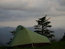
We pitched tent, inhaled all the pasta we had packed up and retreated to our tent for the night.

2:30Am....I found it odd when I awoke to the sound of rain hammering away relentlessly on our tents. The skies were clear with stars everywhere the eyes might wish to wander...very odd....that's when things started to click into place and I was fully awake realizing that we had pitched our tents on a plot of grass that looked too good to be true to begin with and the rain was nothing more than automatic sprinklers that were just doing their job. I took some comfort in our stupidity, excused it hastily with our excuse of being eaten alive, and dove back into a deep slumber that not even automatic sprinklers could pry from my grip....

Wednesday, July 4, 2007

Day 12 (7/4): Missoule MT (0miles, day off)

So yeh...a day off to do nothing to requires any form of physical exertion, except that which to type words onto the computer monitor....

Some information for any one who's been losing sleep lately from not knowing:

1: Total trip miles so far: 1,058 miles
2: Total days of trip: 12 days (11 days biking, 1 rest day)
3: Avg hours on bike each day: between 6.5 hours and 9 hours
4: Avg costs per day: around 8-13 bucks (mainly for food/restocking)

5: Miles from Missoula, MT to Boulder, CO: 1,000 miles
6: For anyone who I emailed the itinerary too...no use in following it anymore...I've revised schedule, will still be done at same date, just tossing the miles around in different ways to increase days I can ride with Stephen and so forth
7: If anyone has tried calling me lately I most likley have not answered (as you've might have guessed by lack of a "hello"..this being blamed on patchy reception areas through most of Oregon, Idaho.
8: I really need to do laundry.

Day 11 (7/3): Eagle Mtn Pack Bridge, ID --> Missoula, MT (87 miles)


Days mileage: 87 miles


(picutres: 1: pair of cyclists from Lexington, Va 2: Stephen and I at Montana border
3: the first bicycle to cross the TransAm bike route)


A new state. Montana...(though if someone looks at the western profile of the state they will clearly see the profile of a man's face...so, it should really be called MAN-tana...just a thought, perhaps?)


Anyways, Stephen and I finally got an early start on the day. A cool, cool mornign, to say the least, that reminded me of cool, autumn mornings from back home in Virginia. I put on all the clothing items I owned and started pedaling as to get out of the "no service" wilderness and get in a decent meal.


Stephen and I both agreed that we must be biking on a tredmill...for the land looked exactly the same as it did yesteday with, hands down, the exact same bends in the road and the river. Luckily, our repetitive thoughts were shattered by seein a pair of bikers working their way towards us. Naturally, we stopped as to chit and chat, chat and chit about whatever. Ends up they live in Lexington, Va and had been on the road for quite a while. They had just retired and were taking as much time as their hearts desired. We then pressed on and ran into a trio of guys biking xc too (2 guys from Brooklyn, NY and one guy from England). We did the same as with the previous couple and pressed on to restock before we made our attack up Lolo Pass and dropped down and over into Montana once and forall.


That's when our fortune, hands down, changed for the better. We ran (or biked rather) into a group of about 20-30 folks who were biking xc, going in the same direction as ourselves, but had a support van...so they were def able to fly by us as we all started to feel the physical and mental strain of climbing up Lolo Pass. We chatted with them too and ends up their riding to Massachusetts and raising awareness for Duchenne Dystrophy....we stopped at t heir group van for gatorade and conversation and knocked out the last three miles of the climb.


Stephen and I raced to the state sign..me losing of course seein my gears would not shift...and, as Stephen stasted, had bigger legs then moi. It was somewhat close and a good way to officially exhaust the legs after that climb. We stopped to take pictures and started the descent into Montana and down towards the towns of Lolo Hot Springs (whcih we didnt' stop at seein it was in the 90's) and Missoula (which is where we planned on stopping and taking a rest day on July 4th.


The Summit of Lolo Pass topped out around 5,200 feet, so we had a nice coast on down for a while before the land tappered out and required a bit mor effort on our part to maintain a speed between 20-25 mph.


We rolled into Missoula around 4:30pm (Rocky Mtn. time) and headed straight towards the Adventure Cycling Association headquarters. There were rumors milling about that they had free icecream and we'd get to sign the registar book and get our pictures taken. We made haste.


It was amazing to get an official tour of the building and got to see a lot of memorbilial from the very first crossing of the country via a velo. We hung out afterwards and chatted with folks who were riding ahead of the group we were passed by earlier. They were still waiting on their arrival and were also taking a day off on July 4th. We continued to pry as to where they would be staying, and that's when they stated they were sponsored by Marriot, among other big companies. Well, well, well. It just so happened we had no place to stay and begged the question as to whether we could sneak in with them.


We got the nod of approval from the head man and will, surely, forever be grateful for such kind gestures towards comfort. We talked more and more with the group members and chaperones who were watching over the kids. Good deal.


It was nice to end the day in an over airconditioned room with over-soft-pillows.


I was looking forward to a day off the next day, glad to be in a new state, and anxious to map out the next 10 days that would lead me down to Boulder, CO where I'd get to see Loretta. I dozed off while writing rambling thoughts in my journal....

Day 10 (7/2): Grangeville, ID --> Eagle Mtn. Pack Bridge, ID (90 miles)


Days mileage: 90 miles


Stephen and I got scolded like little children who were not allowed to sleep on the sacred yard of the Forest Ranger station in Grangeville, which is rather funny to me seeing various folks nodded their heads in agreement that we, certainly, were allowed to sleep on such a plot of land.


We only got scolded once...some top dog ranger dude saying asking if we were part of the forest service..."Uh...no sir....but we were told we, and others, were allowed to camp here if our weary hearts so desired..." "Well, you're not. So pack up and head out ok?"


We rode off towards the rising sun of the east and enjoyed a very steep downhill descent towards more and more one-horse-towns.


Already the heat was chasing us as we traveled along the Clearwater river (what's with following all these amazing rivers and not being able to fly-fish! I haven't had one chance to fly-fish yet and am trying to figure out if I should just mail those items back home).


The day continued in a downward fashion for quite a while, winding through Idaho country land that consisted of evergreen trees of somewhat tall proportions and enough bends in the river for all fishermen to cast a line into.


The biggest task of the day was stocking up and heading into the infamous "66 mile stretch without any form/shape of service." We planned on plowing through as many of the 66 miles as possible and had the game plan of biking until the sunlight expired or our legs fell off from exhaustion....or both.


We accomplished both.


We got 45 of the 66 miles down with and pitched a tent along the Locsha River for the night near the Eagle Mtn. Pack Bridge. It had been a long, twisting, slight head wind, gradual uphill battle since we had passed the warning sign 45 miles back.


The stars were bright, Venus hanging just above the timberline, and a cool mtn breeze rolling gentle through the gorge. It was another long day in the saddle with Montana being our motivation to get rolling early the next day.

Monday, July 2, 2007

Day 9 (7/1): campground, ID --> Grangeville, ID (100 miles)

Days miles: 100

We rolled out of the campground around 9:30 and stocked up on food and fluids at the neighboring New Meadows. The day was already starting to reach an uncomfortably hot level on the local thermometor...so we made haste towards the winding, twisting watershed of the Salmon river which we would end up following for most of the day.

It was great to coast on down into the gorge area...we even ran into another west-bound biker who was from England. He was neat to talk to and a good excuse to rest our legs for a few minutes...

It was close to 100 degrees for most of the day, and we fought a head wind the entire time we followed the river through the steep grade of Idaho mountains. There were little trees along the path and a lot of traffic both on the road and in the river. Stephen adn I did opt to take a quick dunk the river to cooooooooooooooool off seein how monotonous the terrain was gettin and how the head wind was making noticing any progress very difficult.

We took turns in lettin the other person draft off the other, which was a good way to make time pass i guess. I tried to see if I could remember lyrics to some songs I liked, but realized, as I always do, that I can never quite recall all the verses to songs. As I was halfway through running through the Josh Ritter song "Idaho" my bike started to fishtail a little bit and just didn't feel right. It didnt' take too much brain function to realize I had a flat tire...and what ideal timing too!!! I was nearly out of water, exhausted, no food left, and we were only 10 min bike ride from the town were dunna take a break in!!! Hurrah!

Well, I popped the tire off, tried to pump up tire and ride off agains the wind and up the hill....after about 30 seconds it went flat again....dang it.

Long story short (running out of time here in library)...we stopped for lunch in a cafe called Hoot's Cafe (which served horrible Americanized food), patched up the tire so it was better than when it came shipped from teh factory's hands, and started the last big climb of the day....White Bird Mountain. It was another 13 mile climb up 7% grade road...about 2 miles up Stephen said, "Uh...Michael...I think I broke a spoke on the rear wheel."

Nice.

We rejoiced for a brief 3.54 seconds and then assessed the situation and decided to risk it and keep on truckin on and up the moutanin....we had limited time...time was, of the essence and we needed to be in Grangeville....

We got to the summit (~5,200 feet) right when the light vanished and were coasting down the mountain when I saw a big, black animal-like object step out infront of where our wheels were about to roll....i thought it was a bear and was ready to attack with my bike, full speed ahead, when I realized it was nothing more than a bovine (a.k.a.: cow). That's when i knew i had to stop and warn Stephen of this potentially disasterous siutaion. But then, then there were more. Suddenly upon the scene about 13 other bovines joined the one and they all started to muttle about in a shuffle like manner going no where at all....I clicked my bike shoe into the pedal and that's when they all bolted down the mountain road....we followed them closely.

By golly...we were herding cattle! In Idaho! For 3 miles!

The best part is that an SUV was parked at an overlook (I'll assume they were watching the sunset) and all the cattle ran up to the SUV as if it were teh Mama cow and was going to protec them from our charge. the folks in the SUV were pretty startled and were like...wtf? and then they saw Stephen and I ride past waving and laughing all the while...ahhh...nothing like ending the day with a herd of cattle to be herded.

We camped out at a Ranger Station and, after stuffing our stomachs with complex carbohydrates, we called it a night....100 miles with lots of climbing through Idaho....enough said.

Day 8 (6/30): Halfway, OR --> campground near New Meadows, ID (92 miles)

Days miles: 92

Well, well, well..this is the second time i've written this entry for this lovely day...i was about to "publish" it when computer froze. Anways....gotta type it again..so it'll prob be rushed ...

So yeh...we left Halfway, OR with the day still somewhat young and plunged down into Hell's Canyon. We were settin our sights on clearing the OR/ID state border and puttin as much ground between it and our rumps.

The descent down was pretty great (and hot...of course) but the scenery of canyon walls and the infamous Snake River helped distract my distractable mind towards other surroundsings. We finally reached the Brownlee Dam, which serves as the border crossing area and were greeted on the Idaho side by a forest fire that was somewhat contained...phew!

We chit-chatted with the fire fighters who were monitoring their comrads up on the steeply graded Idaho mountains....a sure stumble would result in a plunge towards...well, a long way down to say the least. STephen and I started our own struggle up, out, and away from the border/Hell's Canyon. It was already mid-day, close to 100 degrees, and we had a 13 mile climb that was at 7% grade. yee-haw, right?

Well, we ended up in a campground way, way, way from the border and ended up running into some other bikers who were finishing in the Pacific. It was good to chat with them folks about their own woes and mountains they had to climb. They gave us good warning about what to expect and some other bikers we might run into.

So yeh...ending the day in a new state...a good deal and one state closer to home.