Wednesday, July 4, 2007

Day 10 (7/2): Grangeville, ID --> Eagle Mtn. Pack Bridge, ID (90 miles)


Days mileage: 90 miles


Stephen and I got scolded like little children who were not allowed to sleep on the sacred yard of the Forest Ranger station in Grangeville, which is rather funny to me seeing various folks nodded their heads in agreement that we, certainly, were allowed to sleep on such a plot of land.


We only got scolded once...some top dog ranger dude saying asking if we were part of the forest service..."Uh...no sir....but we were told we, and others, were allowed to camp here if our weary hearts so desired..." "Well, you're not. So pack up and head out ok?"


We rode off towards the rising sun of the east and enjoyed a very steep downhill descent towards more and more one-horse-towns.


Already the heat was chasing us as we traveled along the Clearwater river (what's with following all these amazing rivers and not being able to fly-fish! I haven't had one chance to fly-fish yet and am trying to figure out if I should just mail those items back home).


The day continued in a downward fashion for quite a while, winding through Idaho country land that consisted of evergreen trees of somewhat tall proportions and enough bends in the river for all fishermen to cast a line into.


The biggest task of the day was stocking up and heading into the infamous "66 mile stretch without any form/shape of service." We planned on plowing through as many of the 66 miles as possible and had the game plan of biking until the sunlight expired or our legs fell off from exhaustion....or both.


We accomplished both.


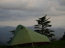
We got 45 of the 66 miles down with and pitched a tent along the Locsha River for the night near the Eagle Mtn. Pack Bridge. It had been a long, twisting, slight head wind, gradual uphill battle since we had passed the warning sign 45 miles back.


The stars were bright, Venus hanging just above the timberline, and a cool mtn breeze rolling gentle through the gorge. It was another long day in the saddle with Montana being our motivation to get rolling early the next day.

Monday, July 2, 2007

Day 9 (7/1): campground, ID --> Grangeville, ID (100 miles)

Days miles: 100

We rolled out of the campground around 9:30 and stocked up on food and fluids at the neighboring New Meadows. The day was already starting to reach an uncomfortably hot level on the local thermometor...so we made haste towards the winding, twisting watershed of the Salmon river which we would end up following for most of the day.

It was great to coast on down into the gorge area...we even ran into another west-bound biker who was from England. He was neat to talk to and a good excuse to rest our legs for a few minutes...

It was close to 100 degrees for most of the day, and we fought a head wind the entire time we followed the river through the steep grade of Idaho mountains. There were little trees along the path and a lot of traffic both on the road and in the river. Stephen adn I did opt to take a quick dunk the river to cooooooooooooooool off seein how monotonous the terrain was gettin and how the head wind was making noticing any progress very difficult.

We took turns in lettin the other person draft off the other, which was a good way to make time pass i guess. I tried to see if I could remember lyrics to some songs I liked, but realized, as I always do, that I can never quite recall all the verses to songs. As I was halfway through running through the Josh Ritter song "Idaho" my bike started to fishtail a little bit and just didn't feel right. It didnt' take too much brain function to realize I had a flat tire...and what ideal timing too!!! I was nearly out of water, exhausted, no food left, and we were only 10 min bike ride from the town were dunna take a break in!!! Hurrah!

Well, I popped the tire off, tried to pump up tire and ride off agains the wind and up the hill....after about 30 seconds it went flat again....dang it.

Long story short (running out of time here in library)...we stopped for lunch in a cafe called Hoot's Cafe (which served horrible Americanized food), patched up the tire so it was better than when it came shipped from teh factory's hands, and started the last big climb of the day....White Bird Mountain. It was another 13 mile climb up 7% grade road...about 2 miles up Stephen said, "Uh...Michael...I think I broke a spoke on the rear wheel."

Nice.

We rejoiced for a brief 3.54 seconds and then assessed the situation and decided to risk it and keep on truckin on and up the moutanin....we had limited time...time was, of the essence and we needed to be in Grangeville....

We got to the summit (~5,200 feet) right when the light vanished and were coasting down the mountain when I saw a big, black animal-like object step out infront of where our wheels were about to roll....i thought it was a bear and was ready to attack with my bike, full speed ahead, when I realized it was nothing more than a bovine (a.k.a.: cow). That's when i knew i had to stop and warn Stephen of this potentially disasterous siutaion. But then, then there were more. Suddenly upon the scene about 13 other bovines joined the one and they all started to muttle about in a shuffle like manner going no where at all....I clicked my bike shoe into the pedal and that's when they all bolted down the mountain road....we followed them closely.

By golly...we were herding cattle! In Idaho! For 3 miles!

The best part is that an SUV was parked at an overlook (I'll assume they were watching the sunset) and all the cattle ran up to the SUV as if it were teh Mama cow and was going to protec them from our charge. the folks in the SUV were pretty startled and were like...wtf? and then they saw Stephen and I ride past waving and laughing all the while...ahhh...nothing like ending the day with a herd of cattle to be herded.

We camped out at a Ranger Station and, after stuffing our stomachs with complex carbohydrates, we called it a night....100 miles with lots of climbing through Idaho....enough said.

Day 8 (6/30): Halfway, OR --> campground near New Meadows, ID (92 miles)

Days miles: 92

Well, well, well..this is the second time i've written this entry for this lovely day...i was about to "publish" it when computer froze. Anways....gotta type it again..so it'll prob be rushed ...

So yeh...we left Halfway, OR with the day still somewhat young and plunged down into Hell's Canyon. We were settin our sights on clearing the OR/ID state border and puttin as much ground between it and our rumps.

The descent down was pretty great (and hot...of course) but the scenery of canyon walls and the infamous Snake River helped distract my distractable mind towards other surroundsings. We finally reached the Brownlee Dam, which serves as the border crossing area and were greeted on the Idaho side by a forest fire that was somewhat contained...phew!

We chit-chatted with the fire fighters who were monitoring their comrads up on the steeply graded Idaho mountains....a sure stumble would result in a plunge towards...well, a long way down to say the least. STephen and I started our own struggle up, out, and away from the border/Hell's Canyon. It was already mid-day, close to 100 degrees, and we had a 13 mile climb that was at 7% grade. yee-haw, right?

Well, we ended up in a campground way, way, way from the border and ended up running into some other bikers who were finishing in the Pacific. It was good to chat with them folks about their own woes and mountains they had to climb. They gave us good warning about what to expect and some other bikers we might run into.

So yeh...ending the day in a new state...a good deal and one state closer to home.

Saturday, June 30, 2007

Day 7 (6/29): Austin Junction, OR --> Halfway, OR (108 miles)

Days mileage: 108

Steven and I descended the first mountain pass we had climbed the evening prior (Dixie Pass) and were looking forward to, nothing more than, finishing the next two passes that lay ahead of us. It was becoming a recurring trend....climbing a mountain pass first thing in the morning, ending the day climbing a mountain pass....and so the woes of a biker goes.

The winds of change did in fact shift all throughout our day; with each twist in the road causing the wind to attack us from an entirely different direction, thus forcing us to re-balance (that's prob not even a word, but whatever) ourselves and maintain our speed.

We had our sights aimed towards Baker City...another western-type looking town that we hoped would have a library with interent access, cell phone reception, and a good place to stuff our faces with food. We found all of that...It was about mid-afternoon by the time we got the 50 miles to Baker City. During the ride Steven and I kept commenting about how much the terrain changes from the birth of each day until it dies at the end....we started in a valley between two mountain passes consisting of tall, tall, tall pines and were ending up (eventually, the day wasn't over yet!) in, aside from the middle of nowhere, a desert.

We left Baker City around 4pm knowing we still had another 58 miles of biking to get to our desired destination....it was a confusing-ly (another made up word for ya) named town called Halfway. We failed to understand what it was halfway between...our closest guess was that it was about halfway between Baker City and the Idaho border. The jury is still out on that one though....

We climbed a steep ascent fighting 20-30 mph wind gusts that tried their best to push us off the road. Once we reached the top we coasted on down, down, down into a gorge-like area where the Powder River flowed in and out, through and to a destination we would never see...we finally got the wind to push us super fast through the gorge-like area.

Things were getting dark in the desert, bit by bit...minute by minute. We still had one last climb up an un-named mountain with an elevation topping off aobut 4,300 feet. It wasn't too, too bad seeing the views as we ascended were nothing less than amazing and "postcard" quality. The mountains now gave off the appearance of being covered by a blanket of clay colored velvet. Small trees and schrubs were scattered in the various crevices where bare traces of water prob tred at some other point in time....

Anyways, highlight of the day was at the end...we had a 7 mile descent into the town of Halfway and had no daylight left. We could see some type of bright, stadium-like lights calling out for us to come closer and see what was going on. The next thing we knew we heard an announcers voice over a loud speaker yelling in an excited voice about some cowboy who was running out of time to lasso the scampering pony....yes, ladies and gentlemen...we had rolled right onto a real, live rodeo. It was the coolest thing and we quickly proped up our bikes and took an awkward seat in the stands...Steven and I hastily agreed that we were the only two homosapiens in the area who were not wearing Wrangler jeans, cowboy boots, flannel hat, and a cowboy hat. Everyone was dressed in their finest pair of jeans, cleanest flannel shirt, and whitest cowboy hat they could find. It was such a sureal scene and one that just sticks in your memory forever. I managed to take a brief video clip of the last round of the rodeo and took some other pics.

Steven and I ended the night by settin up camp behind the closed library. It was that or some RV park with an overwhelming amount of cowboys prancing around in their respective camp rings.

I also learned that such towns do not have phones that have: modern public pay telephones, no cell phone reception, telephones that don't work wtih collect calls...

(I'm typing from a library right now in a town called Cambridge, ID...Steven and I are halfway through a days worth of cycling...we've done 57 miles so far and plane going another 48 to a town called New Fields....more on crossing into a new state tomorrow...trying to keep things organzined on this thing with complete days recorded....)

Friday, June 29, 2007

Day 6 (6/28): Mitchell, OR --> Austin Junction, OR (100 miles)


Steven and I headed out of Mitchell about 8:45 Am...we needed no cup of coffee to get the day rolling...we had a pretty looooong climb to get out

of the town of Mitchell. Once we reached the top it was all downhill for the next 25 miles or so...we were trying to get in as many miles as possible as to adhere to my rough schedule I had mapped out for this trip.


In brieft, it was a long hot day in the high desert land with little, if any, relief from the sun. I know I spent a lot of time hydrating and applying copious amounts of sunscreen....though who knows how much good that really did. We rolled on through a lot of one-horse-towns, which we used to refill our water bottles and stuff down some consumable food products.


Our main goal was to reach the town of John Day in order to resupply our food load and to get in a decent meal and stop at the local library...we accomplished two out of the three. We hit up a Mexican restaurant that fed us very, very well for a great price, stocked up on food, and walked away from the library with big frowns painted upon our faces (their internet access was down for the time being...go figure). It was fine though. We still chatted wtih the librarian and absorbed as much of the A.C. air as our pores would absorb.


We pulled out of that town around 3pm and still had about 30 miles of riding to go....it woudl mainly be uphill from the get-go and one more mountain pass to get up and over. The beginning of the climb was through rolling prarie-like land, with herds of cattle sprinkled about in a random fashion. The views of the tall, towering mountain ranges made for great distractions of the climb that soon lay before us. Luckily, the temperature was gettin cooler and it was mostly overcast at this point in the day.


We trudged onward and upward not really knowing how far from the top we really were. Each winding turn resulted in our disapointment in seein, not a summit sign, but another turn that would result in the same discovery.


About halfway up the climb there was a random viewpoint/overlook for eager-eyed tourists to snap Kodak moments gallor. I took two pictures. One of the mountain range and one of the touristy covered-wagon that was sittin all alone in the parking lot.


Finally, arond 6 or 7ish...we rolled down the mountain for 7 miles straight into Austin Junction. There was only one building there and a field in the back for bikers to pitch tents. Steven and I did just that and went inside to chat with some other bikers that Steven happened to know from a previous days ride. It was great to finally relax, share stories, and meet some new folks. One of them (Gene) is planning on riding through all the 50 states and is raising money for disabled veterans...Steven (a different one) just retired from the Marines and is biking XC and going to end up in Bar Harbor. He's taking his time, taking pictures, rock climbing, etc all the while. Before it got completly dark we all trudged out of the lodge/convenience store and called it a night.


http://www.havetoride.blogspot.com/ = Steven's blog address for further reading/another person's perspective on riding XC

Day 5 (6/25): Sisters, OR --> Mitchell, OR (91 miles)


Days Mileage: 91 miles (for other daily mileage just read the headin of each day...)


Well...I figured I'd wake up feeling anything but excited to get rolling again seein the previous days struggles were still looming within my mind. I did my usual morning "routine", swung by a bakery that had the best bagels I've ever had, was disapointed to see the local fly-fishing shop was closed, and rolled on out of Sisters.


I reviewed the maps earlier that morning and was in for a day of high-desert landscapes with temperatures that would end up being in the mid 80's for most of the day. I wasn't sure what there was to look forward too except that perhaps the day would be over sooner than later...I started to pedal.


The more pavement I put between me and the town of Sisters, the more of an amazing view I had of the Three Sisters Mountain range....def one of my most fav mtn views...fyi.....anyways, I trudged on along at the usual 13 mph, got lost tryin to navigate through the town of Redmund, and then ran into some inspiration...


As I was slowly descending down into the desert land I saw another cyclist who was going opposite direction of me. We stopped, greeted one another, and shared our tales, trials, and tribulations. Ends up that this man was from Tennessee and had started doing this "biking XC" in sections....back in 2002 is when he started. So, he was near the end of his long, hard journey. What really made his journey inspiring was the fact that he was diagnosed with a type of cancer in 2005 (I think). It was in remission now and he was doing what he loved doing....biking. Anyways, we chatted for a good while, I signed his journal for him and then we were off in our different directions. As I coasted past sand covered buttes I was able to appreciate the surroundings a bit more and not just see the place as a barren desert....


The toughest part of the day was the end...go figure, right?


Right.


I had to get through Ochoco Pass and reach the town of Mitchell before it got to being too late in the day. Luckily, the pass was not too step the direction of travel...it was just a looooooong and gradual incline. Furthermore, the winds of the world happened to be blowing against my favor.


The view at the top was quite amazing though....a view of the entire desert area and a brief glimpse of the world that was to pass beneath my feet the following day. I coasted on down Ochoco Pass for 16 miles until I rolled on into the town of Mitchell...


Mitchell is a town with maybe...maybe 200 homosapiens residing in it...and around it. When first rolling into "it" every building is run down, closed, and prob would fall over if one were to even think about leaning against it to rest. I found the center of the town (the entire town being about 1/4 mile) and bought some food from the general store.


There was a free place to pitch a tent, which I did, and then I started talkin wtih some other bikers who were doing the same as I ....just for different reasons.


Long story short....there was a guy named Steven from Berkly who was also biking to the East. We were doing about the same type of mileage/pace and decided we'd try and ride together the following day....


In the meantime I passed the time by playin some old time folk/country tunes with a local yodel. He played banjo and I used their old guitar. It was soooo fun...and a great way to pass time....me and the local guy played tunes until 10pm and the sun was no longer shedding light upon the fretboards. I sauntered back to my tent, crawled inside, wrote some in my journal, and feel asleep in two seconds flat.


Oh...also...there was a town pet bear named Henry. He

lived in a cage in the center of the town. It was pretty cool to see him..though a shame he is even there in the first place....

Wednesday, June 27, 2007

Day 4 (6/26): Vida, OR --> Sisters, OR (102 miles)


Pure frustration and fury is what pushed the pedals up and over the last climb up Santiam Pass. It was nearing the end of what proved to be one of the most trying and difficult days ever....


I had started early from Vida and very eager to start the climb of the infamous McKenzie Pass. It was a solid 22 mile climb to the top with views of amazingness. I was excited. I neared closer and closer to white capped mountains, which for the past 1.5 days had seemed to be sprouting from the lower lying mountains themselves.


I started up the gradual incline of McKenzie Pass knowing that things were only bound to get tougher and steeper from this point on. Elevation changes would be about 5,000+ feet within the next couple hours of biking....and the extra weight on my bike was of no assitance in my attempts to out smart gravity.


Things were fine and dandy, aside from the physical strain, when I suddenly saw a gate. It was locked and stated that the road was closed d/t construction efforts. Damn. I was 11 miles into the climb and now I had to turn around...and then what? Start from the bottom and go the alternate route up Santiam Pass???
Yup Yup.
And that's when the day suddenly went downhill....
I reached the turn off point which I thought I'd never see again and turned onto Santiam Pass route....it was very hot by this point in day, no shade from tree cover, more traffic, and my legs were already burning from the previous climbing attempts. Ontop of that I still had 50 miles to get to the first town....Sisters.
So, I started to pedal, and pedal, and pedal....and was slowing being worn down into the ground by the head wind and unforgiving grade of mountain. Each push of the pedal I kept asking myself who's idea it was to do this thing anyways and so forth. I really can't describe how tough it was and agonizing those miles seemed...partly b/c I've tried to block them out of my mind for the time being. Let's just say, when I finally saw the last switch back that would put me at the top of Santiam Pass I was cursing outloud the whole way at the mountain...when I passed the official "sign" at the top I gave it the middle finger and cruised on down into Sisters....
I coulnd't help but where a face of discouragement the rest of the day...I had climbed well over 8,000+ and my legs were shot. I was drained and in need of a meal, water, and sleep...
As I stumbled towards a Mexican restaurant two friendly looking folks got out of their car and asked me how the riding was going...I proceeded to tell them of my misfortune and they def seemed to sympasize with me seein they lived in this neck of the woods...they understood how steep those climbs could be. Long story short, they treated me to dinner and it was great to talk with about anything and everything. It def made the end of the day worthwhile to say the least. So, after we parted ways I went to the towns park and pitched a tent for the night and slept very, very well.
Anyways, thanks again to Phil and Kris for the great company and conversations!
(above are two pictures...both from the same day for this blog...both pics are of Mt. Washington)